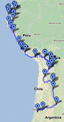
In my infinite census day boredom (I’m relatively terrible at doing nothing, its sort of pathetic) I added all of my South America destination cities to a public google map.
According to Google maps, I’m traveling a total of 4,430 miles through 4 different countries. So far, I’ve gone 2,271 miles, and I have another 2,159 to go.
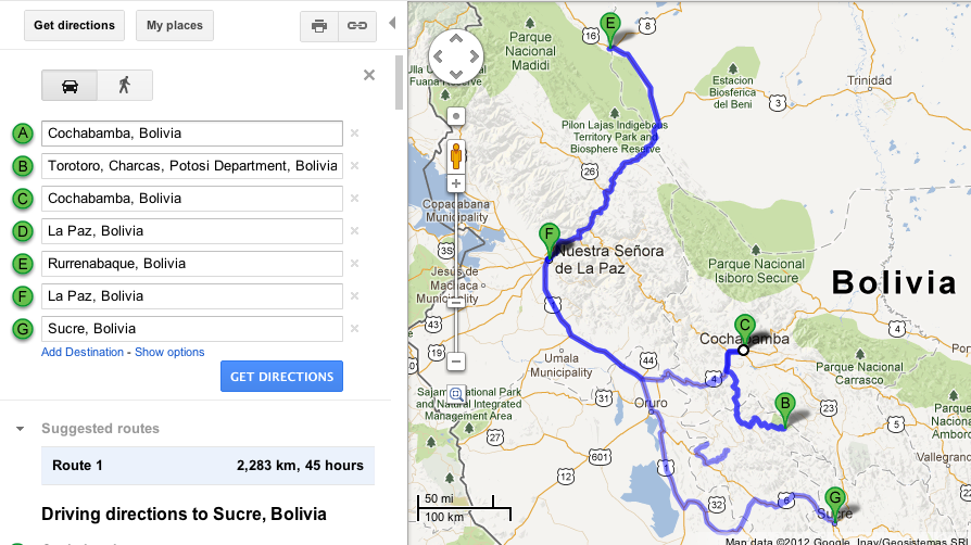
Of course that doesn’t include the flight I’m taking up north to Rurrenabaque, a starting point to see the Bolivian Amazon in the Madidi National Park, or take into account that I’m going down to ToroToro National Park (a six hour bus ride from Cochabamba) and then backtracking all the way back to La Paz (I know, insanity) to catch my flight. This seems relatively insane (especially when you look at the map) but you can only access ToroToro via Cochabamba (and you can’t return to Sucre how I’d originally anticipated) and you can only fly to Rurrenabaque via La Paz. I hadn’t anticipated either of these bizarre Bolivian realities when I’d made my original plans, so now I’m facing the consequences in having to retrace my steps back to La Paz.
Thankfully, that squiggly line headed north is actually a 40 minute flight. Flying is recommended since the roads to Rurrenabaque are windy, not to mention often flooded and dangerous, so I’m paying the $90 each way to fly instead.
It’s crazy to look at a map and see all the distance I’ve covered and all the places I still have to go — it really puts my trip, and how much I’m seeing, into perspective. Aside from playing on google maps, Ann and I also made delicious homemade guacamole. No kitchen required!
Now I’m off to repack and watch some Newsroom!

